In the high Andes, the salt flats are places that showcase truly unique landscapes. Vast, more or less white and always fascinating. In this immensity, the lithium exploitations seem discreet: a few evaporation ponds, low buildings and mounds of salt. However, the private companies that exploit the salt flats control these spaces, as well as their resources and environmental data. Thus, around the Atacama salt flat, it is not uncommon to come across fenced areas. These reveal the importance of information in controlling a resource.
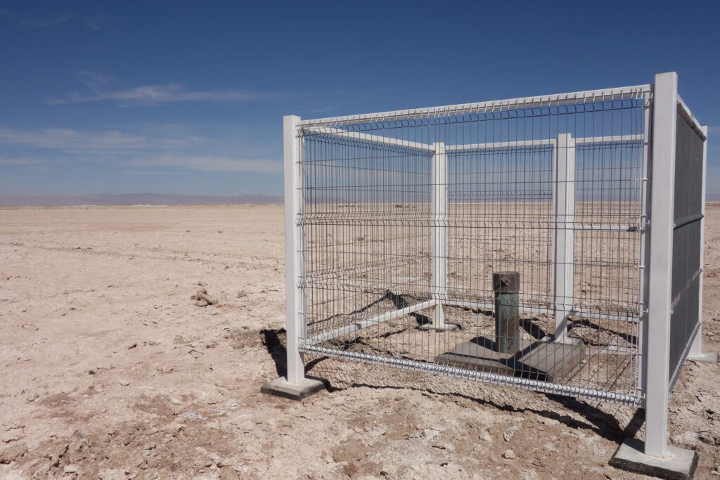
This photograph shows a locking device installed by a private lithium mining company, which ensures exclusive access to valuable data on the environmental impact of its extractive activities. The photograph was taken in Chile, on the Atacama salt flat. Under its barren surface lies the most important lithium deposit of the country. (It is the most important lithium deposit of this country.) Located at an altitude of 2,500 meters and extending over 3,000 km², the Atacama salt flat is an endoreic basin, that is to say a closed valley, whose waterways do not reach the open sea. Large quantities of diverse salts have therefore accumulated there.
Digging wells to access lithium-rich brine at Salar de Atacama
Lithium is diluted in the brines that lie beneath the salt crust. To extract it, wells must be dug, from which the brine is pumped and placed in evaporation ponds. The brine will then undergo solar evaporation, which concentrates the lithium and consequently allows its extraction.
During the exploration phase, any lithium mining project requires the drilling of numerous wells on the salt flat, and sometimes in the surrounding area. These wells are used to evaluate the quality of the brines and to choose the best pumping sites. Once the exploration phase is over, not all of them are used for exploitation. However, not all of these wells are sealed afterwards. Keeping some of them open allows for the collection of brine samples and the continued taking of measurements at different points of the salt flat. This provides valuable data on the water level of the salt flat, as well as on the physico-chemical characteristics of the brine or on the ecosystem of the Atacama watershed.
Valuable environmental data
All this environmental data is valuable, not only for the operating company, but also for the neighboring populations, who are concerned about the impacts of the extractive activity on their territory. Indeed, the communities inhabiting the outskirts of the Atacama salt flat live partly off agriculture and animal husbandry, although they also work – and increasingly so – in tourism and mining. Agriculture and animal husbandry are activities that require a lot of fresh water and are sensitive to variations in environmental conditions, especially in a region as arid as the high Andes. The populations are therefore concerned about the consequences that the exploitation of the Atacama salt flat may have on the water balance of the oases they live in.
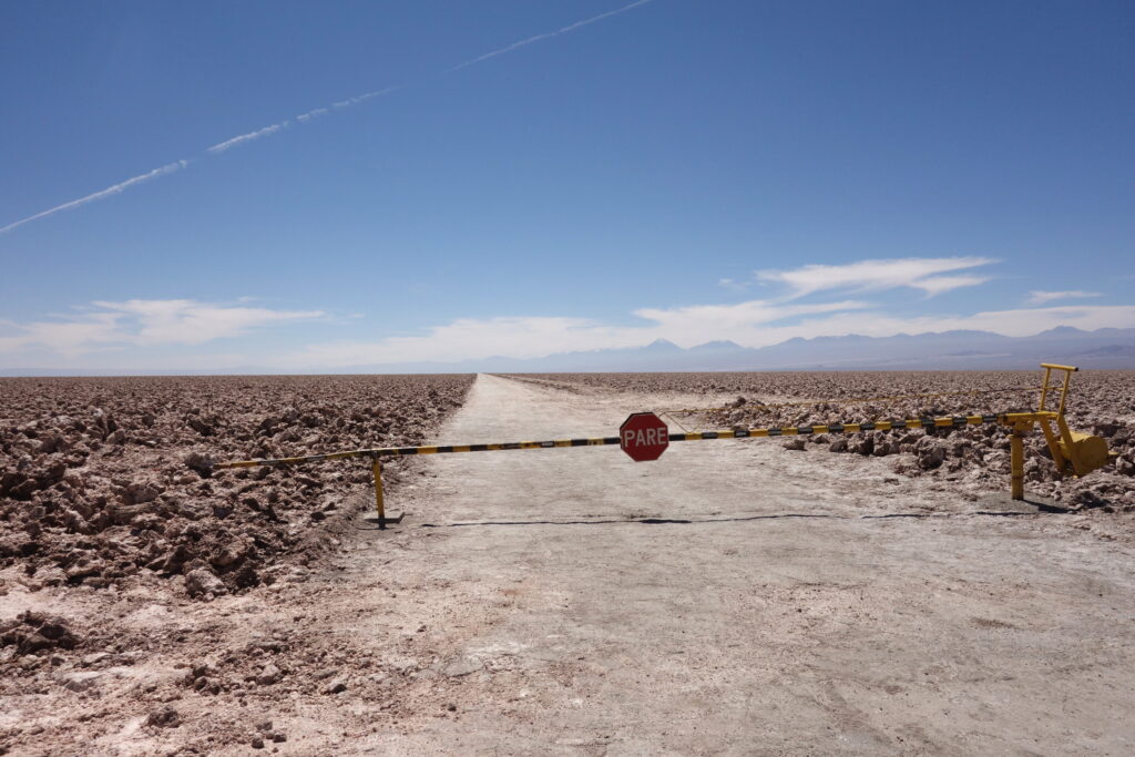
Concerned about the impact of lithium mining, some communities have called on researchers to review the current situation and provide technical support. To do so, these researchers need to study the behavior of the brines, its annual variations, the rhythms of water replenishment at the salt flat and the possible intrusion of saline water into the groundwater (in a system of communicating vessels, the pumping of brine could affect other reservoirs, such as freshwater aquifers, through suction). But their task is complicated. Indeed, the access to all this data is limited. The scientists struggle to access the salt flat itself as well as the wells. They are often faced with barriers and padlocks. One of them expresses their sadness about the situation: “This is how companies prevent access to information; it is impossible to measure water levels.”
The role of data in resource control
The control of environmental data plays a key role in the power relations surrounding lithium resources. On the Atacama salt flat, two private companies – one Chilean, the other American – control the deposit. They control it because they have the technical means of extraction and regulate the access to the salt flat through a system of barriers, but also because they possess knowledge about the resource, the data on the available reserves and on the environmental evolution of the salt flat. Other actors attempting resource regulation are in a situation of dependence on the private companies. This dependence concerns not only the inhabitants of the region, but even the Chilean state. As a matter of fact, the State does not have access to this data either. And it struggles to carry out the environmental controls for which it is responsible (as mentioned in the National Lithium Commission report, in 2015).
The power relations around lithium express themselves in the space of the Atacama salt flat itself. They materialize in space and in a very concrete way on the salt flats. In other words, the exploitation of resources produces power relations that can be read on the territories themselves. Of course, these observations are not limited to the case of Atacama, the locks limit access to environmental data of many salt flats in the Andes.
About the author
Audrey Sérandour (CRESAT / PRODIG) received her PhD from the University Paris 1 Panthéon-Sorbonne. She wrote her thesis on the political geography of Andean lithium (Argentina, Bolivia, Chile) and is interested in the way in which the challenges of the energy transition are transforming the spaces that provide raw materials.